El Paso International Airport (ELP)
Driving Directions / Travel by Car
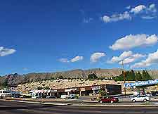
(El Paso, Texas - TX, USA)
Serving El Paso and the Mexican city of Ciudad Juarez, El Paso International Airport (ELP) is located approximately ten minutes northeast of the city. For fast and comfortable access, the airport is situated just off one of the United States' largest interstate highways.
Useful points of reference nearby include the Biggs Army Airfield to the north, Fort Bliss National Cemetery to the northwest, and McKelligon Canyon Park to the west. Many prominent roads are located close to El Paso Airport, such as Montana Avenue, the US-375 (Border Highway), the US-54 (Patriot Freeway) and the US-375 (Purple Heart Memorial Highway).
Directions to El Paso International Airport (ELP) from the city:
- From El Paso, take the I-10 interstate northeast
- Take the Airway Exit and follow the signs for 3 miles / 5 km until you reach the airport's main terminal building
Directions to El Paso International Airport (ELP) from the north:
- US-54 and US-487 highways both lead south to the I-10 interstate, where you head east
- Take the Airway Exit and follow the signs for 3 miles / 5 km until you reach the airport's main terminal building
Directions to El Paso International Airport (ELP) from the southeast:
- Drive along the I-10 interstate until you reach Airway Exit
- Follow the signs for 3 miles / 5 km until you reach the airport's main terminal building
Directions to El Paso International Airport (ELP) from the east:
- Take the US-62 highway west until you see the airport turn off
- Follow the signs to the terminal building
Directions to El Paso International Airport (ELP) from the west:
- Drive along the I-10 interstate east until you reach Airway Exit
- Follow the signs for 3 miles / 5 km until you reach the airport
El Paso International Airport (ELP): Virtual Google Maps
